Information regarding Rennes’ underground line B in open data please
 The roadwork for this new underground line will impact the lives of tens of thousands people in Rennes and its suburbs. Roadworks are already visible today, some power cuts appeared, and this is only the beginning.
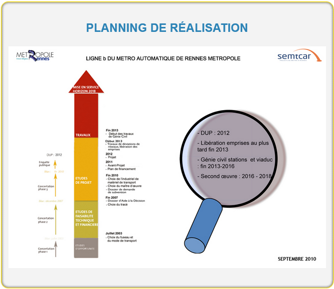
End date of all the work is also of interest. When will we be able to travel by train instead of using our car ? Will the different station be open one after the other ?
Such a large project necessarily includes a political aspect. The declaration of work closure in 2018 seems to be much more politically optimistic than realistic.
 Monitoring of such a project requires resources, being whether people or technical. It is therefore hard to imagine that monitoring tools are not already in use.
Rennes’s metropolitan is already engaged in an open data policy that is really appreciated www.data.rennes-metropole.fr
They have also took care of organizing the internet information channels about this line by opening the website www.metro-rennes-metropole.fr
Can those data be available as open data information ? Roadwork zones, the tunnel boring machine location, status of progress for each station, …
These are public data . They can be used in many ways, the clearest one being the dynamic update of GPS systems.